Property tax is one of the key sources for revenue collection in India — there is no state where property tax is not collected. It is also considered the single most crucial local tax. However, according to reports, India manages to collect only 0.04 – 0.08% of the property values as the property tax, which is one of the lowest in the world. The same study states that potentially, India can generate US$50 billion per annum by maximizing the potential of property tax and user charges.
In fact, with the constant migration of population from rural to urban areas, integrated townships have been witnessing a steady increase in population density. Owing to this factor, the role of a municipal corporation becomes more complicated.
Case in point: Indore municipal corporation was going under tax demand deficit, as many of the properties in the region were not registered in property tax records. According to the municipal corporation, even if some of the properties are in records, they do not have proper usage status or built-up area details updated in the records.
“The traditional systems of revenue collection and management have long been posing challenges for us. A huge gap was generated between the revenue collection system and the growing economy,” said Ashish, Indore’s Municipal Commissioner. “The property details, and water and trade license data was never collated regularly, and the process was filled with loopholes, which have led to revenue leakages in the past,” he added.
Explaining further — most of the time, the information on property tax is not integrated with other information related to the property. Due to this, there has been a lack of convergence between the information stored with the registration department, and accessing information, making it a time-consuming process.
And, “for that, we needed better infrastructure,” said Ashish. “System renovation and augmentation needed to be carried out well in advance so that the need for quality infrastructure can be catered at a reasonable cost,” he added.
The Solution
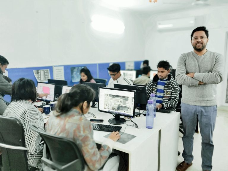
To make the process of tax collection more smooth, Indore’s municipal authorities took the help of Transerve Technologies’s cloud-based software to map geographic locations and structures in city limits. This started to ease the revenue and tax collection process since information about all properties within the corporation’s geographical limits is stored centrally in a database and retrieved when required.
According to experts, more than 200 million people in India lack secure property rights. A lot can be attributed to the massive amount of cost and complexity associated with maintaining property records. Transerve’s solution has been designed to help urban local bodies increase their revenue and improve their civic service delivery by maintaining an accurate database of properties. The solution runs machine learning (ML) algorithms on electricity data, trade license data, property tax records, and other datasets like water and sewerage connections.

Transerve built a map platform for visualizing analytics on geospatial data with buildings highlighted in various categories used to locate each address on the map. It helped the municipal corporation in deploying customized applications for asset tracking/mapping, monitoring of projects, and spatial data collection with geotagged pictures and videos. With the solution, the administrators can also do the property enumeration without going to the field to calculate the total potential tax demand of the city, which can then be updated real-time in the records.
The whole software infrastructure was revamped to have smooth operations and updates. This exercise has reduced field activity for the municipal authorities, which sometimes takes years to complete and costs a huge amount of money to municipal corporations or urban local bodies (ULBs).
“Transerve is focusing on strengthening ULBs by setting up the Municipal Geographic Information System and integrating the same with e-governance modules. Enhancing tax revenues using machine learning in spatial technology turned out to be beneficial for cities across the world,” said Ashish Raj, COO of Transerve Technologies.
He further added, “Our solutions are customized for India, and have been developed considering the modular and scalable nature of the platform — and that is what sets us apart from our competitors. The platform was developed on MEAN stack with NUIS architecture, which is promoted by MaHUA. It is based on microservices, which helps cities in creating an integrated urban data exchange base to collaborate with various departments to build data exchange harmony.”
The platform enables municipal authorities to calculate the actual demand of tax in the city, and the spatial analytics on the TOS platform help the ULBs to improve the efficiency of tax collection. The algorithms run on data from various sources like planning, transportation, land records, etc, which gives an overall city development pattern. With that data in hand, analysts can then categorize defaulters, under-assessed or un-assessed properties on the platform in real-time, and assist tax collectors in recovering taxes from the targeted properties using TOS integrated mobile platform.
The Results
Transerve’s platform not only made the process of data collection easier, but also made it structured, and democratized. The platform helped in collecting, monitoring and analyzing data for widespread projects in real-time for enterprises and individuals.
After the implementation of the services, there was a considerable amount of jump in the overall water tax revenues.
When asked, Ashish from Indore’s Municipal Corporation said, “During analysis, we found that 62% commercial properties, which issued trade licenses were recorded as commercial units in property tax registers, thereby considerably increasing under-assessment. Total commercial power connections were 5198, while property tax records showed only 2570, which means 51% of properties did not declare commercial/mixed usage. These usage-related under-assessment gaps translated to Rs 80 crore of unrealized water tax potential in the 85 wards of Indore.”
With the geospatial solution, fresh property data was collected from the site, which can facilitate a quick reassessment of the property tax. Integrated geospatial tools also helped in the creation, maintenance and retrieval of property data along with geo-coordinates.
Alongside, with various user levels that follow the administrative hierarchy of revenue officials, data security was also ensured as a part of the process, by exclusive login credentials that are password protected and were allotted only to officials. With a single click, a revenue officer was then able to acquire the list of defaulters, which, in turn, helped in enhancing revenue collection in a much-reduced timeframe.
“An efficient GIS can not only help local civic bodies and municipal corporations in monitoring property taxes in an efficient manner but can also facilitate information sharing between various departments, which eventually helps in better local governance,” concluded Ashish.


