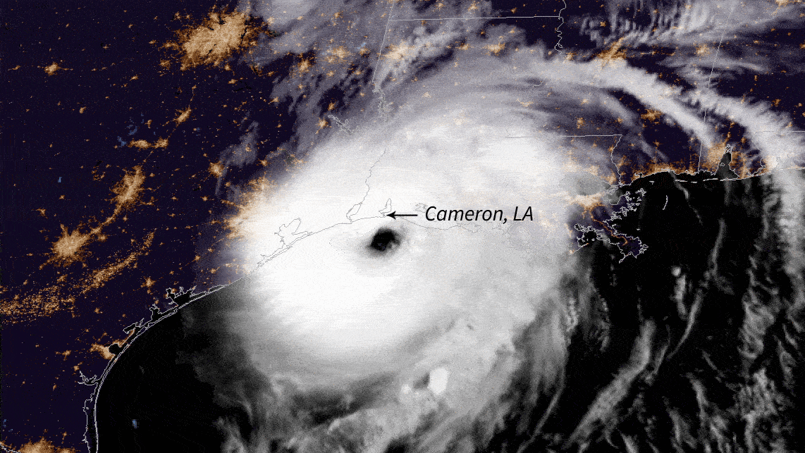


With part of the world dealing with the adverse effects of hurricanes and intense tropical cyclones, it has become imperative for researchers and scientists to develop a way to predict and analyse these hurricane patterns. Thus in an attempt to forecast future hurricane intensity, scientists at NASA’s Jet Propulsion Laboratory in Southern California have proposed a machine learning model that claims to predict rapid-intensification events of the future accurately.
The critical factor in understanding the intensity of a hurricane is the wind speed. Traditionally it has been a challenge to predict the severity of storms or hurricanes while it’s brewing. However, NASA’s new ML model can improve the accuracy of the prediction and provide better results.
Developed via surfing through years of satellite data, this model claims to predict the hurricane’s strength, with more accurate forecasting. This allows people to prepare the way before the storm actually hits. When asked, Hui Su, an atmospheric scientist at JPL said that such a prediction is critical to get right because of the potential harm hurricanes and storms can do to people and property.
Also Read: Deep Learning-Based Hurricane Intensity Estimator To Track The Path Of Hurricane Florence
The Overview of the Tech Behind
The two critical factors of forecasting hurricanes accurately are to predict its track, and it’s intensity. While predicting the track has been successfully achieved by the scientists, forecasting its severity along with its internal characteristics has always been a challenge. Not only because it depends on the surrounding environment, but also facts like rain and wind can be challenging to accurate prediction. Thus, to facilitate this, scientists at NASA worked on a massive amount of data gathered from various satellites identifying the amount of rainfall, wind speed as well as other accessory data related to the hurricane, such as cloud, water vapour, temperature profiles etc.
Firstly, the scientists presented empirical relationships between these measurements and future hurricane intensity change and determined the observation which they can use for their operational forecast model. Post that, the scientists showcased the predictive skill of the machine learning model for rapid intensification in the Atlantic and Eastern North Pacific region with combined predictors derived from the satellite observations.
While examining the ice and liquid water content from CloudSat data, researchers realised that strengthening storms and hurricanes intensity have higher ice and liquid water content but not necessarily higher than weakening hurricanes. Thus, based on the hurricanes potential intensity theory, the outflow temperature in the tropical tropopause layer is critical in determining the maximum intensity of hurricanes. This denotes that it is essential to examine whether satellite information of storm structures can be leveraged to forecast the intensity of tropical cyclones or hurricanes.

Surface precipitation rate in storm-centred coordinate for tropical cyclones.
Based on the wind speed and the data analysed with 24 hours intensity change, the researchers created four intensity groups — tropical depression; tropical storm; Category 1-2 hurricanes; category 3-5 hurricanes. These denote weakening intensification; neutral intensification; slowly intensifying; and rapidly intensifying, respectively.
Also Read: Thunder In The Fog: Why NASA’s InSight Mission Is Truly Poetic
The Machine Learning Model
While achieving the results, the researchers noted that, in each of the groups, the increase of hurricane intensity also increases the inner‐core precipitation rate, which also increases the intensification rate. In this study, the inner‐core refers to the region within about 100km radius of the storm centre, and the results seemed to be not so accurate due to some azimuthal asymmetry in the composite precipitation distribution. Thus, they decided that a wavenumber analysis of the storm-centred precipitation could be the key to predict accurate results.

Left: Inner‐core precipitation rate as a function of hurricane intensity for four groups. Right: Hurricanes future 24‐hr intensity change for all groups.
Further, to predict the power of surplus precipitation and other storm structure measurements, the researchers applied machine learning techniques for predicting rapid intensification with predictors and the parameters involved. By employing logistic regression, random forest, decision tree, as well as IBM Watson studio, the researchers built their ML Hurricane Intensity Forecast Scheme model. The ML models have been trained for the Atlantic and EPAC regions separately using Climate Forecast System Reanalysis and GOES IR database from 1998 to 2008.
Post that, the model is being tested for rapid intensification using the archives National Centres for Environment Prediction data, Global forecast system data and location data for the period of 2009 to 2014. Further, to compare the results of the ML model, the researchers ran it against the NHC operational rapid intensification consensus from forecast reruns.

Predictive skill for rapid intensification occurrence
With these results in hand, researchers showcased how the satellite observation of internal storm structures with parameters like precipitation, liquid content and outflow temperature support a simple relation with hurricane intensification rate when sorted by the current intensity.
Result and Conclusion
According to the results, the proposed machine learning model produces remarkable improvements for predicting rapid intensification (RI) in the Atlantic basin. For such intense RI episodes, the model by the National Hurricane Center has shown low performance in the Atlantic. However, the proposed method increases the probability of detection of the rapid intensification events by ~200% at the cost of only a 6% higher false alarm ratio. Also, the overall skill for these rapid intensification episodes is increased by 138%.
Such numbers highlight that the model researchers developed can easily outperform the traditional model by 37%, and the contribution by adding the surplus precipitation is 24%. The results suggest that “intelligently applying satellite retrievals into the operational forecast with machine techniques has tremendous potential,” concluded researchers.
Read the whole paper here.