
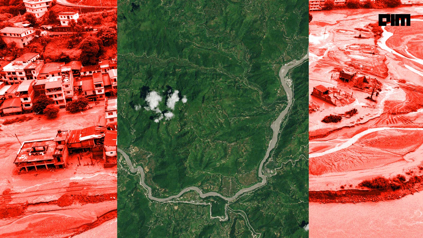
The catastrophe in Nepal and the ensuing tragedy will have deep implications for disaster monitoring, management, and mitigation going forward. Disaster struck almost without warning on August 26, first masquerading as an earthquake before the reality of the flash floods dawned.
By then it was too late. The flash floods wreaked havoc in the Trishuli river basin, causing devastation as far as 100 km away from the glacial collapse.
As of September 2, the death toll has risen to 1,127 and more than 4,800 people are still missing, according to Nepal Police.
However, monitoring glaciers in the Himalayas has been challenging due to extreme altitude, inaccessible terrain, and harsh weather conditions. Researchers and public bodies have been using satellite imagery to assess the dynamic situation. But while satellites can provide the data, they can’t predict. Experts believe that in the near future, artificial intelligence will be increasingly implemented across monitoring, glacier tracking, and weather prediction models.
According to an article by ScienceDirect, AI can identify multiple boundaries all at once, with the help of satellite data from Landsat-8, Sentinel-2, Sentinel-1 radar, and PlanetScope. This can result in real-time monitoring of glacial activity, giving people living downstream timely updates.
The Missing Warning
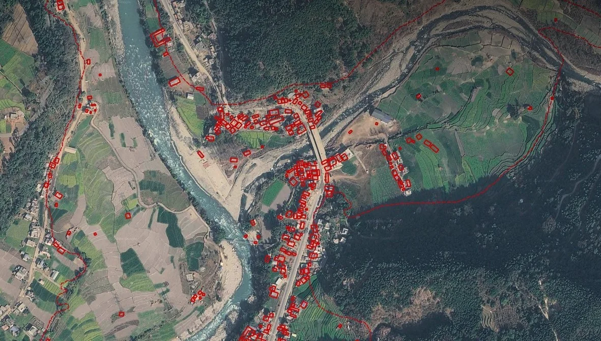
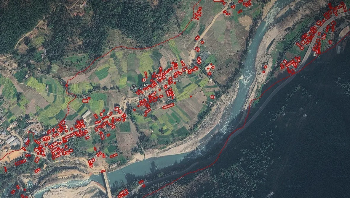
Images provided by entities including Planet Labs, the US-based company which operates the PlanetScope global satellite constellation, offering resolution of 3–4 metres, confirmed that the flash flood was caused by glacial collapse.
“It is almost a replica of February 7, 2021, when Dhauli ganga flooded because of an ice avalanche, resulting in catchment disasters in Garhwal Himalaya,” SP Sati, Head, Department of Basic and Social Science, College of Forestry, Ranichauri Tehri Garhwal, tells AIM. The event is only second to the 2015 earthquake that may have caused the ice to start loosening.
”During that earthquake, several landslides were generated in this valley,” Sati adds. This earthquake created multiple landslides and fractures in the region, which will also likely pose a future landslide risk.
India also faces troubling prospects as the Himalayan chain crowns its boundaries.
The country is home to 9,575 glaciers in the Himalayan Region, according to the Geological Survey of India (GSI). And these glaciers are destabilising due to climate change thawing the permafrost these glaciers sit atop. According to the Ministry of Earth Sciences, the Hindu Kush Himalayan glaciers are retreating at a pace of about 15.5 metres per year.
“Between May and October, rising summer temperatures rapidly accelerate glacial melt, turning high-altitude lakes into something which is no longer a rare threat. Himalayan glacial lakes are expanding rapidly, with their total surface area increasing by over 40% in recent decades,” Vishesh Vatsal, CEO of deeptech company SkyServe, wrote on LinkedIn.
Is India Prepared?
India already has a few systems in place to manage climate disasters.
Beyond using satellite data, organisations like the Central Water Commission track water levels across rivers; the Ministry of Earth Sciences is responsible for studying Earth-related hazards; and the National Disaster Management Authority (NDMA), India’s top disaster-management body, is responsible for developing policies, guidelines, and systems.
They all work together to cover 902 glacial lakes and other water bodies.
Meanwhile, the National GLOF Risk Mitigation Programme in India is installing early warning systems that detect unusual activities, using cameras and sensors. Targeting the red zones of the Himalayan states like Sikkim, Uttarakhand, Himachal Pradesh, and Arunachal Pradesh, also including parts of J&K and Ladakh.
Most importantly, India’s SACHET, an NDMA disaster alert system sends alerts on natural calamities and their precise location through SMS and digital channels. It is available in multiple languages and allows for district-specific subscription.
Future Disaster Monitoring
A research paper posted at ScienceDirect called “Monitoring Earth’s Glacial Lake from Space with Machine Learning” gives insight into how AI can be used to monitor glacial movement through satellite images. Through machine learning and deep learning, the software analyses satellite imagery to identify and monitor glacial lakes.
Using deep learning approaches like U-NET, a type of convolutional neural network made specifically for image segmentation, and merging it with satellites like Landsat-8, Sentinel-2, and Sentinel-1 can help geologists track and monitor in real-time.
However, these systems can only get as smart as the data. The weather, location, and clouds can hamper the data collection efforts. AI models are trained on data from one area or season, which can make them less accurate elsewhere. To resolve this, the paper recommends monitoring the glacial patterns repeatedly instead of mapping them once.
“It is crucial as the size and condition of the Lake can change over time, and these changes can increase flood risk,” Sati says.
According to “Machine Learning for Glacier Monitoring in the Hindu Kush Himalaya,” a research paper published in 2020, glaciers that are covered in debris can be challenging to identify and monitor through satellite imaging. This can lead to automated systems missing identifying parts of the glaciers.
“Debris-covered glaciers are more similar to the background, often leading to false negatives,” the paper noted. Therefore, researchers are combining satellite-based mapping with human verification, alongside making use of machine learning models like U-Net to improve and minimise the time required for mapping.
The Uncertainty
AI can be used in generating maps and alerts, however, the Himalayas may be the real test of AI capabilities. But it is improving. AI can help predict any recent glacial collapse, and map it to the debris arriving at a specific village, hydro-power plant ,bridges, or roads. Creating systems that detect and monitor disasters are not just accessible to the but to the wider public that can receive timely warnings.
AI can also help flag areas that aren’t safe or favourable to build structures, hydro powers, buildings, roads, and bridges. They can be GLOF (Glacial Lake Outburst Flood) areas, debris risk, extreme flood zones, and potential landslide spots.
”Thermal Intelligence can play a critical role in the early detection and monitoring of glacier-related flood risks,” Shravan Bhati, Co-founder and CEO, Satleo Labs, tells AIM. Thermal intelligence can recognise abnormal thermal changes in glaciers, detecting growth of glacial lakes, ice instability, and rapid surface melting.
“These thermal and optical indicators, when fused with weather, elevation and hydrological data, can help identify areas with increasing GLOF or glacier-collapse risk before a catastrophic event occurs,” Bhati notes.
However, these AI prediction systems can fail in the wake of unchecked climate change and the increasing intensity of extreme weather events.
“These types of natural calamities will increase in number and frequency in future,” Sati adds.

Your reaction
Discussion
What's your take on this story?
No comments yet — be the first to share your view.