
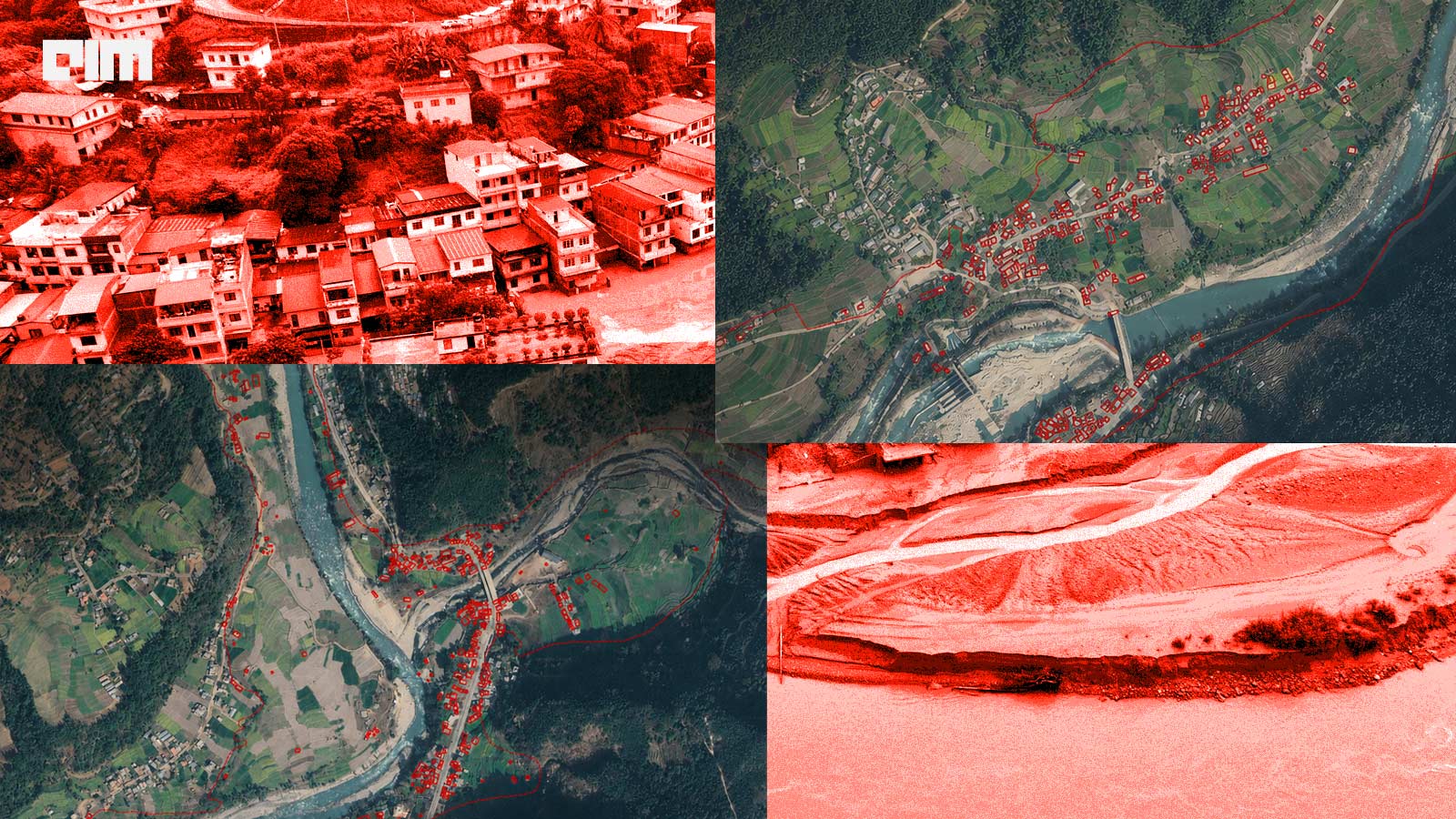
The rippling effects of the deadly floods in Nepal continue to unfold. The death toll has crossed 1,450, with many thousands more still missing.
The floods, triggered by a glacial collapse along the Nepal-China border, destroyed roads, bridges, and hydropower infrastructure. Weeks later, search and rescue teams are still navigating through debris and mountainous terrain to find missing persons in remote locations.
Countries like India, Australia, and the European Union are offering on-air support, with drones enabling assessments of bridges, schools, and critical locations. But another response is shaping online.
The country is increasingly adopting AI to fill information gaps and inform authorities, rescuers, and volunteers.
An Ad-hoc AI System
Niraj Bhusal, an IT engineer at Nepal’s Ministry of Finance, has developed an AI-powered disaster response portal using Grok Bot, the AI model developed by Elon Musk’s SpaceXAI. The ‘Rasuwa-Bhote Koshi Flood’ portal is hosted on GitHub. It tracks casualties, locates the missing, and coordinates with the government for relief measures.
According to The Kathmandu Post, it collects data from government agencies such as the Department of Hydrology, Meteorology, the National Disaster Risk Reduction and Management Authority, security forces, media, official statements, and satellite-related sources. Bhushal built the entire system—from the layout to JavaScript coding—in an effort to centralise fragmented information.
RescueOps and Drone Tech
Adversity forces human ingenuity to solve urgent problems.
While searching for his family, Indian-origin engineer Akshay Bajpai prototyped Mission Rescue, a privacy-focused Android application that monitors official rescue and missing-person information for relevant updates. The aim was to solve for families frantically navigating fragmented sources of information.
“The difficult part was not necessarily the absence of information, but that information was distributed across different institutions and systems,” he tells AIM.
The more visible use of tech in rescue operations is, of course, drones.
China donated four DJI FlyCart 100 drones to Nepal, which can carry loads of up to 60 kg and have been used for transporting food, medication, and fuel to hard-to-reach locations. They have also been used for reconnaissance and to transport corpses.
Australia is also deploying AI-enabled drones equipped with thermal cameras and speakers to survey dangerous terrain, locate survivors, assess damage, and map critical infrastructure. They have mapped nearly 200,000 sq m, with AI helping analyse debris and damage in real-time.
But drones have limits. Aerial survey of underground tunnels is tricky. Mud, debris, and narrow tunnel networks can prevent drones from seeing far enough or reaching potential survivors.
Satellite Mapping
AI-powered geospatial intelligence, HD mapping, and 3D digital twins can help Nepal build longer-term disaster-response capabilities. They can provide detailed maps of roads, infrastructure, and vulnerable areas, helping authorities plan evacuation routes, monitor damage and coordinate rescue operations. Existing technologies for autonomous driving and urban planning, including large-scale road databases and high-fidelity 3D digital twins, can potentially be adapted for flood-risk mapping, infrastructure monitoring, and emergency response.
Sajid Malik, CMD of Genesys International Corporation, a geospatial technology firm specialising in digital twins, 3D mapping, LiDAR, and AI-led location intelligence, works at the forefront of terrain mapping useful for disaster response.
"As an Indian company, we have done the maximum amount of work, perhaps in the world, in terms of creating the three-dimensional data,” Malik states. He traces disasters like Nepal's to unplanned growth in vulnerable terrain, citing Bengaluru constructing over reclaimed wetlands and lakes, and similar patterns in Uttarakhand.
He underlines the importance of “digital twin” modelling, which layers a precise geographic replica with rainfall, terrain, and contour data, to turn static maps into predictive ones. What stands out is how this technology maps onto the entire disaster cycle. Understanding the underlying geography isn't just another perk; it's the foundation for avoiding future disasters through better planning. And when rescue teams can't physically reach a site, remote damage assessment stops being a convenience and becomes the only option.
"Our surveyors could not go there because of the disaster," Malik recalls deploying digital twin mapping during the 2023 land subsidence crisis at Joshimath that triggered an evacuation.
What Comes Next
Once rescue operations wind down, Nepal must determine what needs rebuilding and where.
AI-assisted damage assessment can analyse satellite and drone imagery to flag damaged buildings and infrastructure, letting human teams verify rather than manually inspect every road and bridge across mountainous terrain, a process that can otherwise take weeks or months.
Nepal has already begun this through GeoAI initiatives involving the data sharing non-profit Humanitarian OpenStreetMap (OSM) Team, commercial geoinformatics company NAXA that utilises the OSM data to manage drone imagery and ground-level mapping, and Swiss university EPFL's VITA Lab that has developed hyperlocalised computer vision and deep learning models to analyse drone data..
The next challenge is linking these promising AI and deeptech systems.
Satellites tracking glaciers and glacial lakes, real-time river-level sensors, weather forecasts, and drone inspections, all come together in one chain. Cross-border sharing of glacier and river data matters too, since Nepal's Himalayan hazards and upstream conditions affect downstream communities beyond its borders.
Nepal's disaster has triggered a global deeptech and AI collaboration and tests the limits of how well humanity has developed rescueOps tech for such disasters, which are only going to get worse due to climate change. The next step is making it permanent infrastructure.

Your reaction