

|
Listen to this story
|
One of the persistent challenges in satellite imaging is the dearth of data, especially while using multispectral or optical camera satellite imaging, where the presence of clouds hampers the consistent capturing of data.
Clouds act as the natural barrier to optical cameras and multispectral imaging systems, creating data gaps that impede the monitoring and analysis of Earth’s surface. This challenge is particularly significant in time-sensitive scenarios like environmental monitoring, disaster response, and agricultural assessments, where the obstruction caused by clouds not only disrupts the continuity of observations but also compromises the accuracy and reliability of the gathered data.
GalaxEye to the Rescue
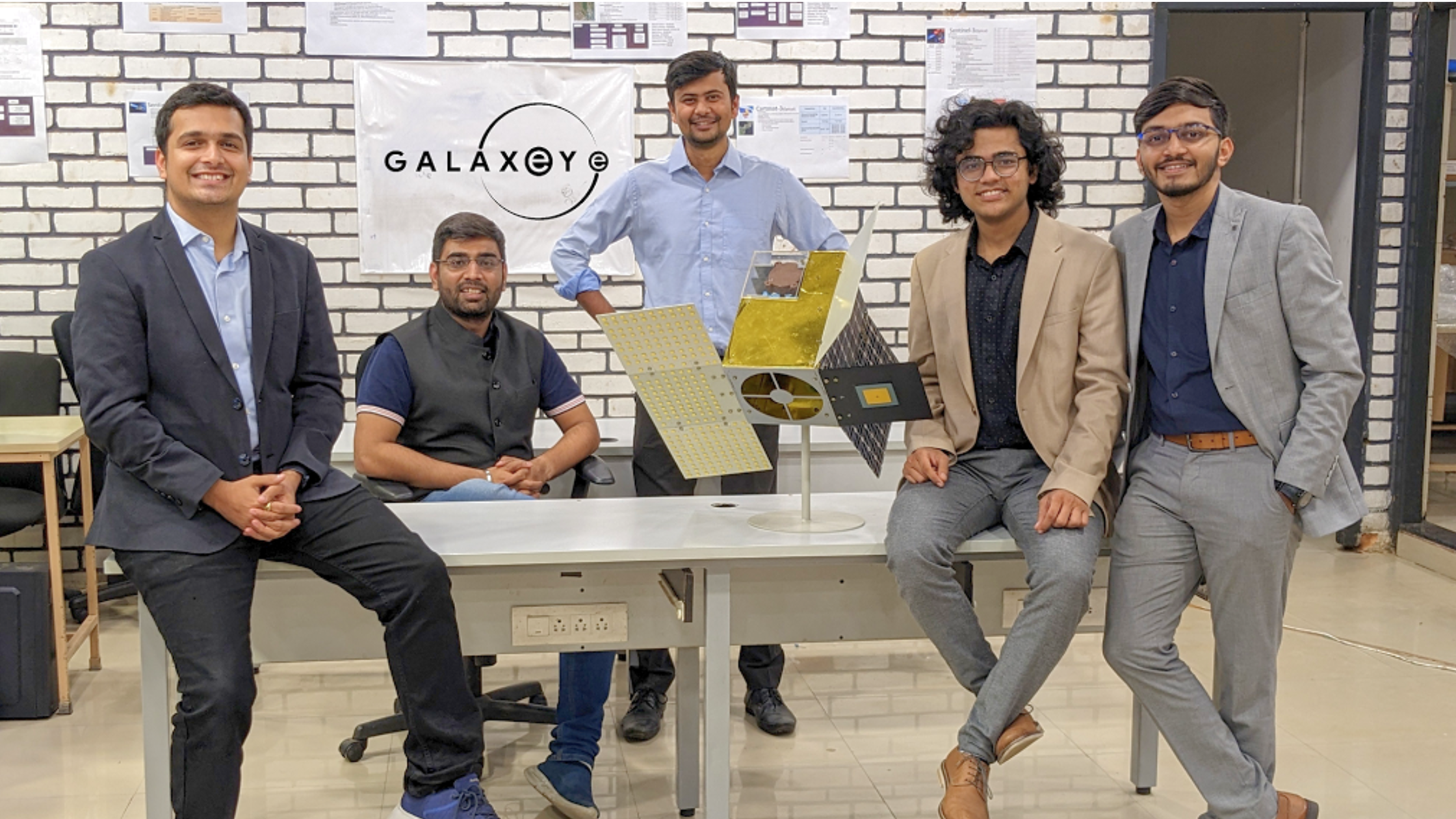
Recognising the severity of this challenge, Bengaluru-based space tech startup GalaxEye is in the process of developing its own satellite — the world’s first multi-sensor micro-satellite called ‘Drishti Mission’ with data fusion capabilities.
Founded in 2021 by Suyash Singh, Denil Chawda, Kishan Thakkar, Pranit Mehta, Rakshit Bhatt, and Prof S R Chakravarthy, GalaxEye operates on a Data-as-a-Service Model, enabling businesses and governments to make informed decisions by leveraging insights from satellite data.
Originating from members of Avishkar Hyperloop, a global competition linked to SpaceX, GalaxEye emerged as part of the FalconX immersion program 2022 in Silicon Valley, California. Currently based in Bengaluru, it has evolved from the Hyperloop team at IIT-Madras.
They plan to launch Drishti Mission in collaboration with ISRO in the fourth quarter of 2024. They have synchronised two complementary sensors, bridging the gap in visual imaging using generative AI through data fusion and integrated synthetic aperture radar (SAR), known for its ability to penetrate the clouds and provide X-ray-like imagery.
“Since the very beginning, our aim has been to render Earth observation feasible across various industries,” said Suyash Singh, CEO and co-founder of GalaxEye, in an exclusive interview with AIM.
He added that he combined multispectral and SAR technologies into a single sensor stack, creating an all-weather, intuitive imagery system.
Addressing the alignment of GalaxEye’s initial mission with its current endeavours, Singh explained, “Our strategy has always involved minimising costs and risks by gradually demonstrating and maturing the technology. This approach, starting with aerial demonstrations before moving to space, allows for iterative development and learning from failures in a stepwise manner.”
The space tech startup recently secured $3.5 million in seed funding, with Special Invest leading the investment round in December 2022. Other contributors include Artha India Ventures, Veda VC, Anicut Capital, Upsparks, and a consortium of notable entrepreneurs such as Nithin Kamath of Zerodha, Prashant Pitti of EaseMyTrip, Abhishek Goyal of Traxn and more.
Tech Stack
“While design and development activities are entirely internal, the manufacturing and assembly were outsourced to the ecosystem,” said Singh. On the software side, the algorithms for geospatial analysis, spanning applications from insurance to agriculture, are also made by the 35+ strong tech team of GalaxEye.
The team primarily works with machine learning and deep learning frameworks. “We are also experimenting with generative AI algorithms to make Synthetic Aperture Radar (SAR) imagery more interpretable,” he added. However, in Singh’s experience, there exist talent gaps in specialised fields like radar algorithms and signal processing.
Discussing the internally developed data fusion technology, he emphasised its potential to provide unique insights and data from space as it aims to enable satellite constellations to perform all-weather imaging consistently, overcoming atmospheric challenges that affect existing single-sensor satellites.
Once fully operational, the constellation is anticipated to achieve global coverage within a 12-hour time frame. The ability to conduct continuous all-weather, all-time imaging, coupled with precise object geometry analysis, offers significant benefits across various industries. These include applications in insurance, precision agriculture, accurate property tax assessments, and the monitoring of utilities such as transmission lines, among others.
Position of Indian Space Ecosystem
Singh, discussing India’s evolving space tech ecosystem, highlighted the complexity of determining the minimum investment for a space mission, attributing it to the dynamic nature of the market.
Despite this challenge, he acknowledged, “We are witnessing a positive trend of growing interest and investments in India’s space tech sector, making it a good time to be in this field.”
Additionally, collaboration between government and private players is one of the strong pillars of Indian space tech, given the geopolitical significance that it holds. Singh stressed that such collaboration plays a pivotal role, signifying a transition from a phase of learning to a more active investment phase.
Last week, GalaxEye and drone tech firm ideaForge partnered to develop an innovative UAV FOPEN Radar, enhancing aerial surveillance for security forces. The radar, overcoming obstacles like clouds and foliage, will provide all-weather surveillance with real-time ground photography, identifying concealed objects behind camouflage or dense vegetation.
GalaxEye has solidified collaborations and business agreements with prominent entities within the space technology domain, such as Antaris Inc., a space software provider based in the US. Notably, the company has forged partnerships with QL Space, XDLINX Labs, Ananth Technologies, and Dassault System.
GalaxEye is committed to further broadening its network of alliances and clientele in the coming months. Demonstrating its ambition, the company has submitted a proposal to IN-SPACe, seeking endorsement and support from ISRO for its initiatives.